Hours & conditions
Park grounds: daily, 8:00 a.m. to sunset (official park page). Hours source ↗
Notice review: The official park page lists regular access hours. No current whole-park closure notice was found on that page at review; this does not confirm live entry. Source ↗
Official sources checked 2026-11-22 08:15 EST. This is a dated review, not a live open/closed signal.
Research-based guide · no field visit claimed
Is this the right hike?
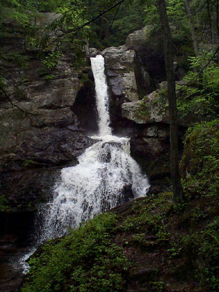
Kent Falls works for a brief scenic stop or a short climb, but those are two different outings. The paved path to the base of the falls is the easier option. The 0.84-mile out-and-back Steps Trail goes up beside the cascades and is rated moderate by Connecticut State Parks because of its steep stairs.
The route
From the parking area, the approach passes the covered bridge and picnic area. The Steps Trail climbs alongside the falls with viewing platforms on the way up; return the same way for the stated out-and-back. A red-blazed return option is shown by the park, but it is a different route. Use the official map if you choose it rather than assuming the 0.84-mile figure still applies.
Getting there
The park address is 462 Kent Cornwall Road, Kent, and State Parks lists daily hours of 8 a.m. to sunset. The state identifies an ADA-accessible path at the base of the falls; that statement does not describe the steep steps route. Parking, restrooms and picnic tables are listed at the park. Check current out-of-state vehicle fees before driving.
Before you go
Stay on the hiking paths and viewing areas. Entering the water or swimming is prohibited. The cascade can be stronger after snowmelt or rain, but conditions vary; do not plan around a promised flow. Leashed dogs are permitted on hiking trails and in picnic areas.
Another choice
For a gentler falls visit, use only the base-of-falls path. For a longer woodland walk with waterfalls, compare Wadsworth Falls and build a route from its official map.
Place and route information reviewed from CT State Parks on September 28, 2026. Conditions, fees and access may change after that date.
Open official trail source ↗Check Blue-Blazed notices ↗